How to Reach Kedarnath
Kedarnath Location & Coordinates
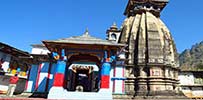
Kedarnath is the blessed town and it is one of the four journey spots which are a piece of Chota Char Dham Spiritual Circuit. It isn't motorable however, yet the confidence of enthusiasts neglects this boundary. Individuals take a 19 km trek to Kedarnath from Gaurikund (Motorable territory) to offer petitions in Kedarnath Temple.
Coordinates of Kedarnath: 30.7346° N, 79.0669° E
Connecting points to Kedarnath
By Air
Jolly Grant Airport is the closest airplane terminal at Dehradun.
The air terminal is associated with Delhi, Lucknow, Mumbai, Bangalore and Thiruvananthapuram.
It is associated with Sonprayag(242 km) through transports and cabs. From Sonprayag, pilgrims have to join shared jeep service to Gaurikund.
After reaching Garikund pilgrims can start trekking to shri kedarnath ji. it is around 19 Km trek to Kedaranath.
By Train
Rishikesh Railway station is the closest railway station from Kedarnath(216km).
This railway station is all around associated with significant urban areas and towns of the nation.
Pilgrim/traveler can book a taxi from the station or board a transport from closest transport station to achieve Gaurikund (And further trek to Kedarnath).
By Road
Gaurikund is the closest motorable zone from Kedarnath.
There are inter and intra state transport benefits that circles it. These transports associates the region with Chamoli, Srinagar, Tehri, Pauri, Rishikesh, Dehradun, Haryana, Chandigarh, Delhi, Uttarkashi, Haridwar and numerous different goals.
Gaurikund is arranged in NH 109.


